
Introduction to Geospatial Services
At Fly North, we’ve embarked on an exciting journey since our inception in 2011, harnessing the power of geospatial technology to serve a myriad of industries across Colombia. Specializing in areas such as photogrammetry, precision agriculture, infrastructure inspection, and oil & gas exploration, we’ve set new standards in delivering high-precision services with an unwavering commitment to quality and efficiency. Let’s delve into the essence of what makes empresas de fotogrametria en colombia, particularly our organization, a critical player in the advancement of geospatial solutions.
Our Photogrammetry Services
Expediting Terrain Analysis
Utilizing cutting-edge drones, we’ve revolutionized the way terrain is modeled, transforming complex landscapes into detailed 3D maps at unparalleled speed and accuracy. Our photogrammetry services offer a granular view of the terrain with precision up to 5 cm in the X, Y, and Z axes, proving indispensable for planning, design, and execution phases of diverse projects.
Ortomosaico and Digital Elevation Models
Our expertise extends to creating Ortomosaicos, where images are meticulously stitched together, correcting geometric errors to present a bird’s eye view with resolutions ranging from 2-20 cm/pixel. Moreover, our digital elevation and terrain models (MDE and MDT) provide foundational data for advanced geographical analyses, including contour mapping and volumetric assessments.
Elevating Precision Agriculture
Empresas de fotogrametria en colombia play a pivotal role in modernizing agriculture. At Fly North, we leverage drone technology for precision agriculture, enabling farmers to monitor crop health, optimize water usage, and enhance yield with unprecedented accuracy. By providing actionable insights, we’re not just servicing the agricultural sector; we’re empowering it to thrive in the 21st century.
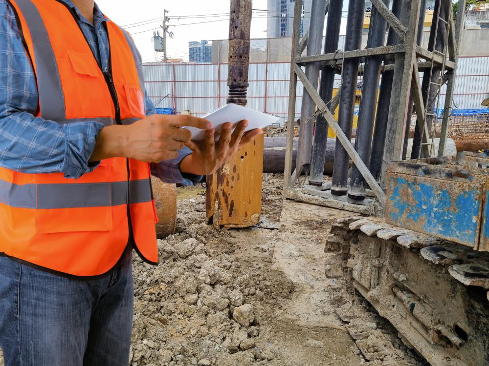
Revolutionizing Infrastructure Inspection
Infrastructure inspection, particularly in challenging or hazardous areas, has been transformed through our drone-based solutions. Our technology facilitates comprehensive assessments while ensuring safety and reducing downtime. This capability is especially beneficial for the oil & gas sector, where infrastructure integrity is critical.
Advancements in LiDAR Technology
Under the Canopy Modeling
LiDAR technology has been a game-changer for empresas de fotogrametria en colombia, including Fly North. It enables us to penetrate dense vegetation, providing accurate terrain modeling underneath the canopy. This feature is invaluable for environmental assessments, urban planning, and archaeological explorations, offering a level of detail that was previously unattainable.
Cost-Effective & High-Density Data Collection
Compared to traditional manned aircraft surveys, our drone-based LiDAR services are not only more cost-effective but also superior in data density. This translates into high-resolution models of vegetation, transmission lines, and built environments, empowering our clients with comprehensive datasets for informed decision-making.
Our Team and Technology
Our interdisciplinary team of electronic and mechatronics engineers, environmental specialists, geologists, and surveyors brings a wealth of experience in drone applications. Combined with our fleet of over 8 drones and the expertise of 5 certified pilots, we’re equipped to tackle projects of any scale, ensuring adherence to aviation regulations and safety standards.
Collaborating with Clients
Understanding that each project has its unique challenges and requirements, we pride ourselves on our collaborative approach. By working closely with our clients, we tailor our services to meet their specific needs, ensuring that the solutions we deliver are not just effective but also innovative and bespoke.
Our Achievements and Future Directions
Over the years, empresas de fotogrametria en colombia, like Fly North, have significantly contributed to various sectors by providing geospatial solutions that drive efficiency and insights. Our portfolio of satisfied clients across Colombia is a testament to our commitment to excellence. As we continue to explore new frontiers in geospatial technology, our focus remains on empowering industries with precision, reliability, and actionable data.
Let’s Connect
Located in the heart of Medellín, Colombia, we’re always ready to address your geospatial needs. Whether you’re embarking on a new project or seeking innovative solutions, reach out to us at +57 (4) 604 4914 or via email at info@flynorth.com.co. At Fly North, your vision is the blueprint for our next geospatial adventure.
What is the Role of Photogrammetry in Modern Industries?
Photogrammetry, at its core, is the science of making measurements from photographs. It’s a game-changer for many industries, allowing us to capture large swathes of terrain or intricate details of a structure with precision and speed. Think of it like painting, but with numbers and data instead of brush strokes. In industries ranging from construction, agriculture, to urban planning and environmental conservation, photogrammetry provides a basis for informed decision-making by transforming visuals into actionable insights. For instance, a construction manager can visualize a future building in its environment or an agriculturist can monitor crop health over vast areas with precision. It’s about bringing data to life in a way that’s both accessible and actionable.
How Have Drones Revolutionized Data Collection in Photogrammetry?
Drones or UAVs (Unmanned Aerial Vehicles) have been nothing short of revolutionary in the photogrammetry sector. Compared to traditional methods which might involve manned aircraft or satellite imagery, drones offer a blend of high-resolution data capture, versatility, and cost-effectiveness unmatched by conventional means. It’s similar to the difference between taking a road trip in your car versus walking: both can get you to your destination, but one offers a quicker, more efficient journey. In our experience at Fly North, using drones has enabled us to undertake projects that would have been unthinkable a decade ago, ranging from inspecting remote infrastructure to detailed agricultural analysis, all while ensuring safety and reducing environmental impact. The fusion of drone technology with photogrammetry has indeed heralded a new era for geospatial sciences.
What Makes Photogrammetry Essential in Precision Agriculture?
Imagine being able to zoom in on a single plant in a vast field, understanding its health, hydration levels, and nutrient needs. That’s the magic photogrammetry brings to precision agriculture. It’s not just about creating pretty pictures from above; it’s about deriving detailed, actionable insights that can guide everything from watering schedules to harvest times. At Fly North, we’ve seen how this technology can transform the agricultural landscape by enabling farmers to maximize yields, reduce waste, and mitigate risks, all in a sustainable manner. The ability to monitor crop health and environmental factors with such precision is invaluable in addressing the challenges faced by modern agriculture.
What are the Common Challenges in Photogrammetry and How Does Fly North Overcome Them?
Like any advanced technology, photogrammetry comes with its set of challenges. Data overload, for one, can be daunting; the sheer volume of information captured in a single drone flight can overwhelm traditional processing software and techniques. Then there’s the challenge of accuracy – ensuring that the data we collect and the models we create faithfully represent the real world. At Fly North, we tackle these challenges head-on with a combination of proprietary software, expert analysis, and continuous innovation. Our team of engineers and specialists work tirelessly to refine our data capture and processing methodologies, ensuring that we deliver precise, reliable results every time. It’s a blend of art and science, where every challenge is an opportunity for innovation.
Where Do You See the Future of Photogrammetry Heading?
The future of photogrammetry is as expansive as the view from above. We’re standing at the cusp of a new era where integration with artificial intelligence (AI) and machine learning (ML) technologies will unlock unprecedented capabilities. Imagine automated analysis that can identify changes in terrain, health of crops, or even early signs of infrastructure wear and tear with minimal human intervention. At Fly North, we’re excited about these possibilities and are actively exploring ways to integrate these advancements into our services. The goal? To offer not just data, but insights that are more predictive, actionable, and tailored to the unique needs of our clients. As we move forward, the sky is not the limit; it’s our canvas.
How Can Potential Clients Engage with Fly North for Their Photogrammetry Needs?
Engaging with us at Fly North is as straightforward as reaching out with your vision. Whether you’re pondering over a new project or seeking innovative solutions to existing challenges, we’re here to transform your ideas into geospatial realities. Clients can contact us directly through our phone line at +57 (4) 604 4914 or via email at info@flynorth.com.co. Our approach is collaborative and tailored; we believe in understanding your unique needs and working together to craft solutions that not only meet but exceed expectations. Let’s embark on this geospatial adventure together – your vision, powered by our expertise.
Resources
- NASA – Explore the latest advancements in LiDAR technology and its applications in various industries.
- Australian Government Department of Agriculture, Water and the Environment – Learn more about precision agriculture and how it is revolutionizing modern farming practices.
- U.S. Geological Survey – Access valuable resources on terrain analysis, digital elevation models, and other geospatial data.